| Home | > | List of families | > | Asteraceae | > | Cirsium | > | palustre | > | Record no. 29 |
Details of record no: 29
Cirsium palustre
Three blocks of information are displayed on this page, namely: (a) details of the record; (b) the record point plotted using Google Maps and (c) any images attached to the record. Please scroll down to see the various items.
Record details:
| Date: | 24 Jun 2008 |
| Recorder(s): | MA Hyde M Harvey |
| Collector(s): | |
| Determiner(s): | |
| Confirmer(s): | |
| Herbarium: | |
| Habitat: | In open marshy ground |
| Location: | Derwent Grange Farm, Co. Durham |
| Location code(s): | |
| Outing code: | |
| Planted code: | Not planted |
| Country: | England |
| Vice-county: | 66 |
| Grid reference: | |
| FZ Division: | |
| Altitude (metres): | 180 |
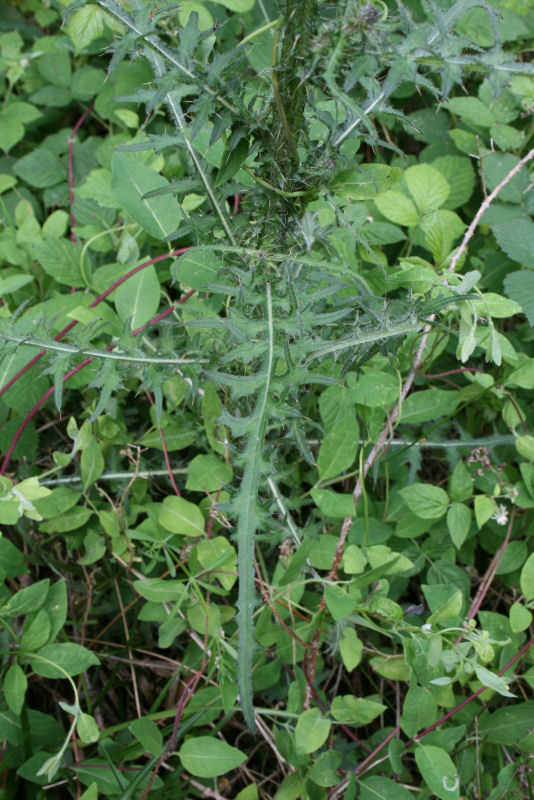
| Notes: | Lower part of stem |
| Latitude, Longitude: | 54.842890, -1.887150 |
| Location Accuracy Code: | 0 |
Map of species record
Images:
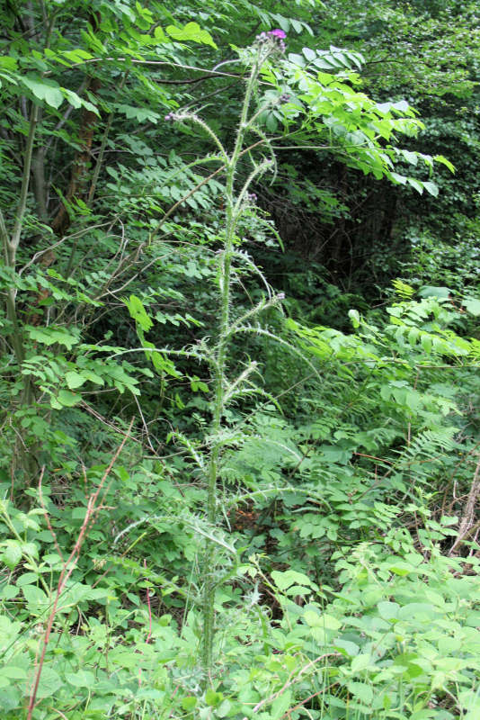
Image: 1

| Species id: | 150390 |
| Image id: | 1 |
| Image number: | 15 |
| Photographer: | MA Hyde | Code 1 if image of a herbarium specimen: | 0 |
| Herbarium in which image taken: | |
| Code 1 if image not to be displayed: | 0 |
| Image notes: | Whole plant |
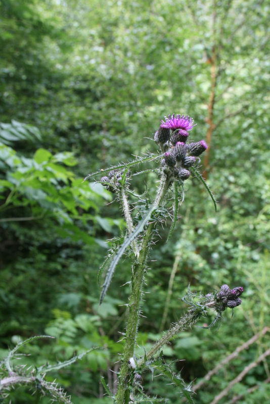
Image: 2

| Species id: | 150390 |
| Image id: | 2 |
| Image number: | 16 |
| Photographer: | MA Hyde | Code 1 if image of a herbarium specimen: | 0 |
| Herbarium in which image taken: | |
| Code 1 if image not to be displayed: | 0 |
| Image notes: | Upper part of plant |
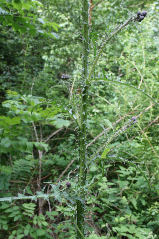
Image: 3

| Species id: | 150390 |
| Image id: | 3 |
| Image number: | 17 |
| Photographer: | MA Hyde | Code 1 if image of a herbarium specimen: | 0 |
| Herbarium in which image taken: | |
| Code 1 if image not to be displayed: | 0 |
| Image notes: | Mid-stem |
Image: 4

| Species id: | 150390 |
| Image id: | 4 |
| Image number: | 18 |
| Photographer: | MA Hyde | Code 1 if image of a herbarium specimen: | 0 |
| Herbarium in which image taken: | |
| Code 1 if image not to be displayed: | 0 |
| Image notes: | Lower part of stem |
| Home | > | List of families | > | Asteraceae | > | Cirsium | > | palustre | > | Record no. 29 |